apAdventures

Raining Cats & Dogs

July 29th, 2006

Well, today we’ve been officially “rained out” of climbing. It’s been a while since we were rained out, hmmm, a year? Two years? Since we arrived in Tucson? Since we left Pittsburgh? Typically, when it rains, we just hunker down under the rocks until the rain passes. Shoot the bull for about an hour or so, and then waa-laa, rock is dry and up we climb. On this occasion, however, we are genuinely “Rained Out”. We awoke to thundercracks around 4am or so and it’s been dumping ever since. And I mean DUMPING. CONTINUOUS dumping. We had plans to head up to Mt. Lemmon today, but due to tropical storm so-and-so, here we are at home, watching it pour. But all is well. It’s amazing how living 3 years in the desert can make you truely ache for rain. Yearn for that rainy day where you actually have an excuse to sit around inside all day, make warm drinks, bake an apple pie, ahhhh it’s raining.

Click on the photo to see more.


The Front Yard.

Canada Trip Report

July 16th, 2006

And now for the trip report of our 10-day vacation in the Canadian Rockies with Paul’s parents, Marian and Regis. The idea of doing this trip with family originated back when Paul and I were on our honeymoon in the Canadian Rockies. This area of Canada was so amazing to us that we just had to share it with both our families. Unfortunately, my family was unable to join us on this occasion, so it ended up just Regis, Marian, Paul and myself. Overall, the trip was stellar. Traveling with Paul’s parents was a blast and the scenery in the mountains of Canada is, of course, absolutely breathtaking. The four of us hiked up some really incredible (and really strenuous!) terrain. To write about all the fun would take me a week, so I’ll share with you just some of the highlights:

Our trip started off in Seattle, Washington. From there we made our way up to Yoho National Park, British Columbia. Our first hike of the trip was the Iceline Trail. The trail starts off with a pretty steep grade, switchbacking up an avalanche slope and then into an old-growth forest. Immediately, we had fine views of the Yoho Valley, the impressive 833 ft Takakkaw Falls, and the Daly Glacier which feeds the Takakkaw Falls (Takakkaw is Cree for “It is magnificent!”). After the switchbacks, we were above treeline and traversing through rocky, unvegetated landscape. At about 2.5 miles we reached the Emerald Glacier. Paul and I ran ahead a bit to get a closer glimpse of the glacier while Regis and Marian took in the views from the glacier’s forefield. After a rest and some snacks, we turned around and headed back down the same way we came up. Stats: 5 miles, 1815 feet elevation gain, 4 hours.


Hiking up the switchbacks on the Iceline trail. The avalanche slope in the background. Click on the photo to see more.


Takakkaw Falls with the Daly Glacier above. Click on the photo to see more.


Iceline Trail. Click on the photo to see more.


Emerald Glacier. Click on the photo to see more.

Our next big hike was in Banff National Park at Lake Louise. Lake Louise is one of the most popular areas in all of the Canadian Rockies. The Lake Louise Chateau is situated right on the lakefront, providing stunning views of the turquoise blue Lake Louise and the massive glaciers above it. We came up with a perfect hiking day plan that allowed Paul and I to get some trail running in while still getting to meet up and hike with Regis and Marian later in the day. Paul and I took off running toward the Plain of the Six Glaciers. The trail runs along the side of Lake Louise and then gains elevation to the glaciers behind it. The end of the trail brings you to the exposed crest of a lateral moraine that overlooks the Lower Victoria Glacier. Above us, we had views of Abbot Pass separating Mt. Lefroy (11,230 feet) and Mt. Victoria (11,364 ft), which marks the Continental Divide. Far below us, we could see the entire Lake Louise and the Bow Valley. From here, Paul and I ran the Highline Junction trail that took us up and over the Big Beehive (steep!) and down to Lake Agnes. Meanwhile, Regis and Marian hiked the Lake Agnes trail up to Lake Agnes and we all rendezvoused at the Lake Agnes Teahouse. Perfect timing! Stats: 11.6 miles, 2243 ft elevation gain (twice, due to having to run up and over the Big Beehive), 6 hours (including a stop at the teahouse for lunch).


Lake Louise. Click on the photo to see more.


Paul staring up at the Continental Divide at the Plain of Six Glaciers viewpoint. Click on the photo to see more.


Looking down on Lake Louise and the Chateau at the Plain of Six Glaciers viewpoint. Click on the photo to see more.


Running the Highline Junction trail toward the base of the the Big Beehive. Click on the photo to see more.


Lake Louise from the top of the Big Beehive. Click on the photo to see more.


The Lake Agnes Teahouse. Click on the photo to see more.

Probably our most favorite hike of the trip was this next one. Lake O’Hara in Yoho National Park. Lake O’Hara is THE MOST popular hiking destination in Yoho National Park. And it only takes a quick glance at these photos to figure out why. The area is so popular, in fact, that access is limited to visitors. To get into Lake O’Hara, you have two options: Reserve a seat on one of the 6 buses that travel up there each day (for a *very* pricey fee), or hike the 7 miles up/in. Or, well I suppose there’s a 3rd option: RUN the 7 miles. 😉 Paul and I laced up our running shoes, reserved 2 bus seats for Regis and Marian, and said “see you at the top!” The run in was awesome. The air was cool and crisp and the morning light was casting deep blue shadows across the snow-covered peaks around us. Soon we arrived at Lake O’Hara and met up with Regis and Marian. From here, we walked along the lake together and then split again, planning to reconvene later on the trails. Paul and I decided to take the All Souls’ Alpine Route. Wow, was that trail EXPOSED!!! The trail pushes up through scree and boulder fields to some pretty airy ledges, a couple of which you actually have to do 1 or 2 moves of scrambling (hands & feet) – a few moments of glee for these two rock climbers. 🙂 From the All Souls’ Prospect (the summit point of the trail at 7380 feet) we traversed a couple of small snowfields and then headed over to Opabin Lake where we met up with Regis and Marian again. From here, we all hiked together back down to Lake O’Hara, passing a family of mountain goats along the way. Regis and Marian then boarded the bus, while Paul and I downed a couple sticks of beef jerky and then ran the 7 miles back down to the car. A satisfying day indeed. Stats: 19.5 miles, 2131 ft elevation gain, 7 hours.


Running the road into Lake O’Hara. Click on the photo to see more.


Lake O’Hara. Click on the photo to see more.


Some exposed scrambling on the All Souls’ Alpine Route. Click on the photo to see more.


The view of Lake O’Hara (on the right) from the All Souls’ Prospect (look carefully for the dirt road we ran in on). Click on the photo to see more.


Traversing the snow. Click on the photo to see more.


Lake Opabin. Click on the photo to see more.

After our Lake O’Hara hike, we drove north on the Icefield Parkway toward Jasper, Alberta. Here are a couple of the many, many glaciers and icefields along the way:


The Crowfoot Glacier.


The Athabasca Glacier.

The final hiking day of the trip involved a little jaunt out to Maligne Lake and then a walk along Maligne Canyon. Maligne Canyon is an impressive “must-see” for Jasper. It’s a slot canyon and at its deepest is 180 feet, at it’s narrowest only 3 feet!! Stats: 2.6 miles, 345 ft elevation, 2 hours.


Paul, April, Marian and Regis at Maligne Lake. Click on the photo to see more.


Maligne Canyon. Click on the photo to see more.

From Jasper, we said good-bye to the magnificent Rockies and traveled west toward Whistler, Biritish Columbia. We checked out the ski slopes at Whistler-Blackcomb. The place was packed with outdoor enthusiasts: mountain bikers, snowboarders/skiers (you can ski on the glacier in the summer!), climbers, hikers, zip-liners,….pretty much any nutty sport you can think of….it was there. After Whistler, the highway took us right by Squamish. So of course, as climbers, Paul and I couldn’t resist the urge to stop at look at the rock wall and touch the boulders. It didn’t take us long to regret not bringing our climbing gear, so we high-tailed it out of there ASAP.

Once back in Seattle, we spent a couple days with Paul’s Aunt Marilyn, Uncle Bob, and cousin Chris. The weather was beautiful. Marilyn and Bob gave us a tour of the city…by boat! They also filled our ears with story after amazing story of the incredible skiing and snowboarding up at Whistler-Blackcomb, tempting us to consider a trip up for a visit this winter. Perhaps we will be back in Canada sooner than we think. 🙂

Redpoint on the Trail

June 30th, 2006

Paul and I are sitting in the Phoenix airport right now. (Free airport internet! Cool!) We’re awaiting our flight to Seattle. In Seattle, we will meet up with Paul’s parents and then spend the next week driving, hiking, and running through the Canadian Rockies: Yoho, Banff and Jasper National Parks.

We sit here in the airport, our bellies full from nasty airport sandwiches and LOTS of water, and our legs aching. We look at each other with distant stares…exhausted. We cherish every second of sitting, simply sitting, on our tired butts and doing absolutely nothing besides waiting. What the heck? Why?

Because the Imogene training continues and boy are we dedicated. This morning we rolled out of bed at 4:45am just so we could squeeze in a run before catching our Phoenix flight at 3pm. And not only are we psyched about our dedication, but we have an exciting accomplishment to report: This morning, Paul and I finally conquered (or as we like to say, “redpointed”) the Douglas Springs Trail all the way to Douglas Springs Camp and back. A grand total of 12 miles and 2000 feet gain with NO WALKING. It took us 3 hours. The trail starts at the end of Speedway Blvd and runs up into the Rincon Mountains on the east side of town. The beginning is probably the steepest section, but it’s a reasonable enough grade that one can run it continuously (well, amatures like ourselves, anyway). We’ve been getting up early on weekdays and tackling this trail before work for the last 3 weeks; each run getting a little further up the trail then the last. Today we pushed hard. Whew, we’re beat!

I’ve been a runner for the last 16 years. I’ve been a “trail” runner for the last 6 months. And as I trudged my way back to the car (with Paul dry-heaving behind me, haha), I realized that I had never run so far with no stops….ever. What the hell have I been waiting for?! 🙂

I Got Soul, and I’m Super Bad

June 25th, 2006

We’ve put together a video of the “Super Bad” duo, Holly and Joe, ticking off some of the classic boulder problems at Priest Draw in Flagstaff, Arizona. Watch out, they are climbing S T R O N G.

Currently, the Brins fire and others are burning up around Flagstaff. Due to the extreme fire danger, they’ve closed the Coconino National Forest until the monsoon rains come. Unfortunately, this means Priest Draw is closed as well. Hurry up monsoons!! We’ve got more climbing to do!

Fleet Feet

June 19th, 2006

On the way home from work today April and I finally managed to find some time to stop at Fleet Feet, to get some expert advice about running shoes. Pete, the owner, happily greeted us and quickly went to work. He measured my feet, made me run on the treadmill, video taped my motion from several angles, analyzed my style, and recommended several shoes to try out. Believe me, I give this guy a lot of credit because my warped climber toes are not that appealing to deal with. Pete was very polite and even recommended socks that at least made my toes look somewhat normal. I tried several pairs of shoes on but I knew as soon as I slipped on a pair of the Montrail Hardrocks that I found what I was looking for. Finally, I think I have a good pair of shoes to tear it up on the trails. I can’t wait to head out for a run Wednesday morning and test them out…


The Hardrock by Montrail

Pass/Fail in Flag

June 18th, 2006

This weekend Paul, myself, my sis Holly, her boyfriend Joe, lil Morgie and our friend Matt headed up to Flagstaff, AZ for some fun in the cooler temps. We camped at the campground on Upper Lake Mary and bouldered Friday and Saturday at Priest Draw. The beginner duo (Holly and Joe) is climbing strong, I must say. We showed them the classics and they ate them up, one by one, until the skin on their fingers was toast. Paul is currently working The Receptionist, v10, and making strong links (falling while “answering the phone” – for all you familiar with the climb). I’m working Anorexic, v6, and slowly sussing out the moves. Paul and I have a trip to Canada coming up soon so unfortunately we may not be back to the Draw for a little while. No biggie, our projects will be waiting when we return.

Sunday, Holly and Joe sped off with their mountain bikes to the Mt. Eldon trails, Matt sped off with his bike to Sedona, and Paul, Morgan and I headed up to Mt. Humphrey for some Imogene training. So far in our training, our runs have been successes. We’ve completed every trail run that we’ve set off to do and have loved every second. Well, today’s run was a bit less of a “success”. We hit the trail this morning at 9:30am. Way, way, WAY too late. We had planned to run a 12 mile loop that included the high point of Mt. Humphrey at 12, 000+ feet. About 6 miles in, however, as we stared up and up and up at the peaks above, we made the decision to bail. Yes, BAIL. Believe it. To sum up our position: we were low on water and hot as hell. Running above treeline in this kind of heat would be too much for little brown dog Morgie, and us too I suppose. So we turned around and ran/walked the 6 miles back to the car. Out-and-back runs = blah. 90+ degrees when your psyched to bag a 12,000+ footer = blah. A tired dog with tired legs and that oh-so-pitiful look of “take me home please” = blah. But, knowing that this stellar loop with amazing views exists and is only a short 4 hour drive away = CAN’T WAIT TO COME BACK AND TRY AGAIN!!!! 😀

Committed

June 4th, 2006

Two weeks ago, Paul and I, our friend Courtney, my sister Holly and Morgan were running along some trails up at the top of Mt. Lemmon. As we were trotting along, Courtney brought up the idea of Paul and I running the Imogene race in Colorado this year. A race? We’re always up for a fun little race every now and again. Colorado is beautiful….sounds fun!

Ok, a little more explanation please: The Imogene Pass Run is a 17.1 mile point-to-point mountain race within the western San Juan mountains of Colorado. Ahem….emphasis on the word ‘mountain’. The route connects the towns of Ouray (7810 feet) and Telluride (8820 feet) by way of the 13,120 foot Imogene Pass. You do the math. We’re talking MASSIVE elevation gain here.

So we’re trotting along up on Lemmon, tired, dehydrated and obviously completely delirious because Paul and I said “Let’s go for it.”

The race is scheduled for Saturday, Sept 9th, 7:30am. And today marks the first day of mine and Paul’s PTA Training (PTA = Pain, Torture, Agony….a trademark reference by our friend JR). After a grueling 9 mile-er this morning, we sat down in front of the computer….and…..registered. No backing out now.

Stay tuned for the success…or failure…of April & Paul’s ultimate trail running adventure up and over Imogene Pass this September 9th:


Imogene Pass, Colorado

Posted in Running | 1 Comment »

Home Improvements

June 4th, 2006

We’ve decided to embark on a little home improvement project: The Courtyard Porch.


Tearing down the old porch. Click on the photo to see more.

Bishop Adventure

May 30th, 2006

This Memorial Day we had a long 4 day weekend off from work so we decided to pack the Subie with 4 adults, 1 dog and a crapload of gear and zoomed the 12 hours to Bishop, California. It was myself, Paul, my sister Holly and her boyfriend Joe (who will also be staying with us for the summer), and lil brown dog Morgan of course. Also, please don’t let me forget, our Sherpa Courtney who also joined up for the trip. He drove himself and met us there and was sweet enough to stash 4 of our crashpads in his vehicle. Thanks Courtney!


Packing the Subie. Click on the photo to see more.

Thursday evening we hit the road and made it to Barstow, CA around 3am. We were aiming to stay at some KOA we saw on a map but somehow stumbled upon this rundown campground in a ghost town. Really! Calico Ghost Town: It’s an old deserted silver mining town that was re-vamped for tourism back in the 50’s. As we were setting up camp (at 3am) and nice little old ranger drove up to our site. Tainted by the strict rules of Hueco, I automatically assumed he was here to a) yell at us for coming into the park so late, b) yell at us for letting Morgie run around without a leash on, and then c) yell at us cause we didn’t drop our money into some pre-pay drop box or something. However, to my surprise this kind man did none of the above. He actually commented on Morgan being a “fine looking animal” and said to don’t worry about paying him until the morning, after we get a good night’s rest. Ahh, this was going to be a good trip. 🙂


Calico Ghost Town camping. Click on the photo to see more.

We awoke around 7am, ate breakfast and decided to have a look at the ghost town. Our campground fee included entry into the town, so we said why not. It was actually pretty cool. Then it was off to Bishop.


Calico Ghost Town, Barstow, California. Click on the photo to see more.

Got into Bishop late afternoon on Friday and chilled a bit in town. Then we headed up to the Buttermilks and found ourselves a stellar camping spot overlooking the Peabody boulders with the snow-covered mountains in the background. Absolutely beautiful.


Buttermilks camping. Click on the photo to see more.

The temps were rather mild – much cooler than usual for this time of year – and there was rumer of some high winds that were due to rip through town the next day. Well, the winds started picking up right around the time we were trying to cook dinner Fri night. Pleasant gusts at first….then kinda annoying gusts….then really annoying gusts. We all ate about a pound of dirt that night with dinner.
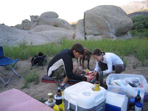

Dinner. Click on the photo to see more.

Exhausted from all the driving, and anxious to get away from the wind, we all hit the sack somewhat early. By this time, however, the wind was already ripping through the mountains like a bat out of hell. Now this wasn’t just the kind of wind that if you try hard enough, you’ll eventually fall asleep and tune it out. Oh no. Not this wind. Ooooohh no sir. As I am laying wide awake in my sleeping bag, trying to ignore the snow-globe of dust that was the inside of our tent and drowning out thoughts of how much dust could one actually breathe in before it made one sick, plugging my ears with my fingers to both a) gain some relief from the loud howls of wind and b) keep the dust out, and did I forget to mention getting wacked in the face every 10 minutes by the ceiling of the tent as it heaved and flopped and hoping, almost praying that the next gust wouldn’t tear a gaping hole through the flimsy nylon walls, …..I am wondering to myself….wow, this must be exactly like how it is on Everest!! Except just replace the snow with dirt!

After 3.5 hours of this nonsense, Paul said “THAT’S IT – we’re moving to the car.” I’m not sure how, but Paul and I and Morgan managed to squish into the back end of the Subie. Cramped? VERY. But boy, once we closed those doors, it was like being in an airtight vault. I never slet so sound.

The next morning we all awoke, brushed off the dirt, and made our way to the Happy Boulders. Our original plan had been to spend the entire trip up at the Buttermilks, but the wind had only temporarily let up and the temps were dropping. The Happies were calm and cozy. This was a first-time bouldering day for Holly and Joe and they did great! Noteworthy sends of the day go to Courtney on the highball classic Heavenly Path v1, Paul on Pappachubby v8, and Joe on Corner v0 (who loved it so much he repeated it!).


April on Big City Boy v6. Click on the photo to see more.

Sunday morning the group split up into our own mini-adventures: Myself, Paul and Morgan headed toward the Buttermilk boulders. Joe and Holly went up into the mountains in search of the white stuff (both are crazy addicted snowboarders/skiers). And Courtney also headed up in elevation to solo traverse this ridge he was eyeing.


Courtney’s quest. Click on the photo to see more.

For Paul and I, no big sends, but wow did we get on some classics boulder problems – including Saigon (v7) for me and The Checkerboard (v8) for Paul.


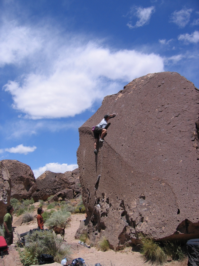
A classic Buttermilk highball warm-up. Click on the photo to see more.


Paul on Checkerboard v8. Click on the photo to see more.

Joe and Holly found some of their beloved snow, and I’m sure rolled and frolicked in it to their heart’s content.

Courtney, however, got shut down on his adventure. Not by the ridge, but by a nasty headcold that was creeping upon him. Too much dirt in the lungs for that boy. Oh well, nothing a little hard whisky can’t fix (compliments of Courtney’s friend Linda who met up with us later in the day). Thanks to Linda and her whiskey, we all got a little wild as the night rolled on – cooking up massive amounts of fahitas and chillin’ to the good ‘ol Dr. Dre of course.


You rock, Linda! Click on the photo to see more.

Monday morning we all rolled out of the tents, packed up and headed into town to have breakfast at the Bishop Grill. A quick stop for some Eric Schaat’s Bakery treats, big cups of coffee, and then we were back on the road headed home. All in all, a great trip indeed.


The crew.

Back From Bishop

May 30th, 2006

We made it back from a long weekend in Bishop! It was cool, literally! Details tomorrow…


Courtney – Climbing one of the many classic problems at the Happies