apAdventures » Hiking

First Hike

October 27th, 2009

Paul and I took little Silas on his first hike on Saturday. We decided on the Douglas Springs trail, since this is my all-time favorite. Silas liked it so much, we took him on another hike Sunday – the Meadow Trail up at the summit of Mt. Lemmon. Well, we *think* he liked the hiking anyway. He just slept and made these little puppy sounds the whole time. 😉


Silas’ first hike. The Douglas Springs Trail.


Cozy in the carrier.


Happy Dad. The Douglas Springs Trail.


Zonked! What a hike.


The Meadow Trail, Mt. Lemmon


Momma & Morgo


Dad & Bambino

Day 152: The Perfect Birthday

November 11th, 2008

Yesterday was Paul’s Birthday. Hip hip hooray! Keeping with the birthday celebration trend set forth on Manu’s October birthday here in Bishop, Paul and I ventured out on a little hike. This time around Lake Sabrina, our first zero-elevation gain hike….deeeelightful. See the beautiful snowy pics below.

This year, with all this glorious free-time I have right now, I wanted my present to Paul to be geared toward the act of doing, not buying. So last night over a ripping hot campfire at our campsite up in the cold, cold Buttermilks at the base of the Sierra Nevadas, I made Paul a homemade pepperoni pizza in my dutch oven. For those that don’t know Paul, the man would eat pepperoni pizza every single day of the year if I’d let him! To my surprise (since this was my first attempt at campfire pizza), it turned out to be homemade campfire perfection!!! We enjoyed the pizza, our cokes (a double special treat) and the roaring campfire well into the evening, with little Morgie curled up beside us on the crashpad. The moon is almost full right now and from our site we could see the Buttermilk Boulders almost perfectly, gleaming in the moonlight below us. A wintery hike, warm campfire and homemade pepperoni pizza. I think he liked it.


Homemade pepperoni pizza. Mmm.


Our new campsite


Lake Sabrina

posted by arr

Day 126: Birthday Hike

October 21st, 2008

Happy Birthday Manu! A Bishop birthday celebration isn’t complete without some yummy “Pullaway” bread from Erick Schat’s Bakery and a pleasant hike up to Piute Pass with your bestest buds:


Manu and Pullaway Bread. Mmmmm.


The hike up to Piute Pass


The view into the Sierra Mountains at Piute Pass


Manu and his Birthday Crew, from left to right: Grit, Manu, Anke, Morgan, April and Paul

posted by arr

Bishop Pass

October 12th, 2008

Two days ago, before the snow came, we managed to sneak in a high elevation hike. We started at South Lake and trekked six miles up 3000 vertical feet to the boundary between the Inyo National Forest and the Kings Canyon National Park at Bishop Pass: 11,972 feet elevation.

posted by pjv

Big Cat with Black Spots

August 4th, 2008

It was a dark and dreary day…..dud, dud, duuuuud….

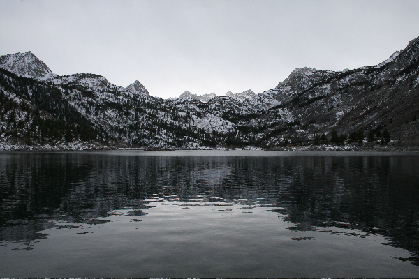
And the Rocklands proper was deserted of climbers. The overcast clouds had been releasing a steady mist all morning, leaving the typically vibrant orange rocks dark grey and dripping wet. No climbing today. A perfect excuse for a lazy rest day. Or for some, a perfect day to explore.

These two explorers pulled our little Volkswagon go-cart rental into the empty gravel parking lot, zipped up our raincoats and stepped out into the blustery cold wind and dense mist, camera, video camera and bouldering guides in hand. Our mission was to search out a bouldering area called The Fortress, of which we had not yet been. The guidebook and fellow climbers promised a slew of classic lines here.

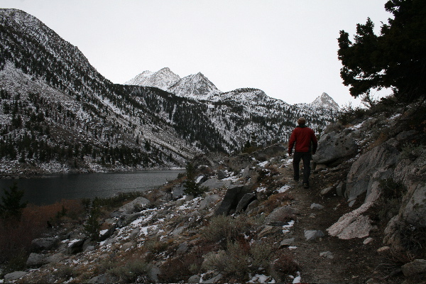
We set off up the familiar dirt road into the Rocklands proper, which provides access to many of the popular areas: Roadside, Road Crew, Cedar Rouge, and the mysterious Fortress: a giant, bright orange warehouse-sized block that sat atop a prominent boulder-strewn hillside.

At the road-side cairn marking our single-track approach trail, Paul and I gaze up at The Fortress across the meadow, high on the hillside above us. The distant block and surrounding boulders were just barely below cloud-level. The cloud cover was moving right-to-left over the tops of the rocks at an unnaturally fast rate. It seemed as if we were watching a fast-forward video. Every now and then the fiercely strong wind would tear a slice of moisture off the main cloud mass, leaving the rogue wisp whizzing across the front sides of the boulders, hiding the boulders’ soaking grey faces for a brief moment as it zipped by. “Looks cold up there,” Paul says to me. I agree and we tramp on.

After crossing the meadow, we see another large cairn that marks our next turn. We are now faced with a boulder-scrambling maze of cairns up the prominent hillside upon which The Fortress sits. We start up, gaining elevation quickly, our vantage point above the meadow below getting more and more impressive with every step. Our sneakers and pantlegs are getting more and more soaked with every step too! Every weed, grass and wildflower in our path is weighted heavily with wet beads of moisture. We continue up.

Eventually, the hillside appears to plateau out and Paul and I realize that we’ve reached our destination. The giant Fortress looms directly above us, it’s flat summit hidden in the mist. Surrounding us are dark grey gargoyle figurines wrapped in white cloaks….I mean, dark grey boulders wrapped in mist and clouds. Wow, is it spooky up here.

We remedy the eery feeling by pulling the bouldering guide out of our backpack and hunting for climbs. One by one, we find the classics, running around like kids on Christmas day. There is one set of boulders however, that has us stumped. We can’t find the line Stargate. Did we pass it and not see it? We circle around again, confused. We’ve found every line up here except this one. According to the guide, it should be right next to the boulders we’re standing at, but either we’re wrong, the guide is wrong, or the Stargate has disappeared into another dimension. Perhaps the line has been transported through the giant car-sized circular hueco in the rock tower behind us…a.k.a “the Stargate?”

Frustrated, we give up on Stargate. And it’s at this point that we realize the clouds have completely engulfed the top of this hill, and us. We look out into the valley behind The Fortress and see the clouds racing by, at eye-level now. This is really creepy, we both agree, and decide to document the phenomenon with the video camera.

Perched up on a boulder, Paul and I sit silently and motionless with the video camera running, letting the wind whip past our cold faces, listening to it howl at an unsettling volume through the gargoyle-like features in the rocks. It seems to be getting louder. Is it the wind? Or my heightening sense of sound, amplified with each additional minute we sit?

After about 10 long minutes, the eeriness of our perch in this ominous place is too much to bear and Paul breaks the silence with “Let’s head down.” He scrambles off the boulder and begins packing up our camera. I take one last look at the valley and then turn around toward Paul and climb off the boulder, facing forward.

Stepping off the boulder onto the dirt, I raise my gaze from my feet to the giant car-sized circular hueco in the rock tower now directly in front of me. My gaze abruptly hones in on the body of a large, dog-sized, blond cat with black spots, crouched in front of the rock tower not 20 feet away, it’s head turned toward me, it’s eyes staring squarely back at mine. “The elusive leopard,” my brain registers, regurgitating the text of our South Africa Lonely Planet guidebook.

With my unobstructed view, the animal appears to be in mid-departure from us, having stopped briefly to look back and take inventory of the strange 2-legged creatures scrambling off the boulder. Upon eye contact, the cat immediately bolts away from us and it’s at this point that I am finally able to blurt out the forced hushed words “It’s a f’in leopard!! It’s a f’in leopard!” to Paul. My vulgarity at such a beautiful and amazing National Geographic moment startles me almost as much as the cat.

Paul wheels around 180 degrees, but it’s too late. The cat has already bounded up and behind some rocks out of sight. We both stand there dumbly, unsure of what to do next.

Then, from behind the rocks the cat’s large head pops up to take a peek at us. We stare at the cat, and the cat at us. The 2 or 3 seconds that probably truly tick by during this stare-down feel much more like 2 or 3 minutes. I’m amazed at how strikingly friendly the cat’s face appears, so sweet and kind and cute, like a kitten’s. Only…..larger.

The head disappears. We continue to stand, silently frozen. Then, a moment later, the head reappears. The cat is playing peek-a-boo with us. This time though, Paul interrupts the 2-3 second (or 2-3 minute?!) staredown. “Let’s roll.”

We grab our camera (having not taken a single shot of this beautiful animal!) and high-tail it out of there, our enchantment replaced with fear.

Within minutes we’re off the hill and back down in the meadow, scooting quickly and deliberately back to the car. Eventually, as we near the car, our pace slows down and our conversation speeds up. The fear has now been replaced with enchantment again and we re-cap the sighting, second-by-second, kicking ourselves for not having taken a picture.

Back at the farm we confirm our sighting with Thys, the owner of the farm. He is astonished that we, visitors having been here in South Africa a mere week, saw the animal that he has been trying to get a glimpse of his entire life. “No one sees the leopard,” he informs us, “No one. You two are VERY lucky.” Later that evening at a braai (cookout) that Thys and his neighbor threw for the climbers staying on the farm, the news of our leopard story buzzed. Tale after tale was told of the many locals who have tried to see this astonishing animal. Footprints in the sand and dead sheep in their pastures was the closest they had ever come to the elusive leopard.

Walking back to our little cottage late in the evening, while the fire of the braai and the laughter of climbers still roared, Paul and I reflected on our good fortune. The stories from the locals sealed our realization of how incredibly lucky our sighting was, making the entire experience all the more mystic.

posted by arr

Day 13: Rest Report

June 25th, 2008

We’re up here in RMNP again. This time for a 3 day onslaught. Yesterday climbing, today resting, tomorrow climbing.

Today’s rest day included a hike and chess. We hiked the Flat Top Mountain trail (towards Flat Top mountain). Got a late start (of course, cause it’s a rest day, duh!) so had to deal with the afternoon thunderstorms…which ended up turning us around before the summit. Well, that and the 2+ feet of snow up there. Regardless, we got a great vista of Dream Lake from above and Chaos Canyon from afar – awesome perspective compared to being right on top of these areas when bouldering.

The chess portion of the day was awesome as well – cause it was my first time ever playing!! Woohoo, this trip is educational! I kicked Paul’s butt. Ok, just kidding. I got slaughtered, haha

Campsite 102 at Moraine Park, RMNP

View of Bierstadt Lake from Flat Top Mountain Trail, RMNP

View of Longs Peak from Flat Top Mountain Trail at the Dream Lake vista, RMNP
Bear Lake, RMNP

posted by arr from the Coffee on the Rocks coffee shop in Estes Park, CO

Back to the Big G.C.

April 30th, 2008

The family fun started off with some local activities: a day trip to Bisbee, a hike on Mt. Lemmon, good food and lots of tequila. Part II of the family fun took Paul, myself, brown dog Morgan, and my parents to the Grand Canyon for a few days. My mom had never seen the canyon before, my father just got a quick glimpse of it back in ’03, and the last visit for Paul and I was the big “Grand Canyon Adventure” in Oct of ’06. So needless to say, all of us were all pretty anxious to do a little more than just the standard peer over the South Rim, tourist style.

The original Plan A was for the four of us to all hike down to Plateau Point together; a nice little family day hike. ‘Nice and little’, however, is hardly an accurate description. After Paul and I refreshed our poor memories with the fact that this was a 12.2 mile hike roundtrip, with over 3,000 feet elevation gain (ahem,”loss”), we all quickly realized that this wasn’t quite what we had in mind for a fun family hike. Thankfully, we realized the magnitude of this hike up on the Rim versus down in the heated depths of the Canyon, (contrary to all the misfortunate hikers in “Over the Edge: Death in Grand Canyon;” a *fascinating* book of gruesome cooked-to-a-crisp mishaps in the big G.C. that we picked up in the gift shop and just CAN’T PUT DOWN!) 🙂

On to Plan B. Now, let me just mention one thing here – had Paul and I devised Plan B in the car on the way to the G.C., it most likely would have gone something along the lines of a moderate out-and-back, minimal elevation, perhaps hiking the Rim Trail from start to finish, etc. But no. The answer to Plan B was immediately dictated upon our first glance into the Canyon and down at Plateau Point: Paul and I were going. And that’s all there was to it. We *had* to go. The gravitation of the Canyon was practically yanking us off the South Rim. Come on in! It’s a party down here! Perhaps this is the natural tendency of the massive Canyon….does everyone feel this way or is it just us? Or perhaps the big “Grand Canyon Adventure” pried open another passion that is quietly, patiently waiting for us to get this rock climbing obsession out of our blood so that we can move on to bigger mileage mentality (not likely, haha). Whatever the case may be, Paul and I decided right then and there that we were goin’, and goin’ in deep.

So Plan B turned out to be this: Paul, myself, Mom and Dad would all leave the South Rim together and start heading down Bright Angel Trail. Paul and I would run, and Mom and Dad would hike. After 2 hours of downward progress, the plan was for both parties to turn around and start heading back up to the South Rim. At 2 hours, Paul and I estimated we’d be at Plateau Point (6.1 miles) and my parents somewhere around the 3 mile rest-house. Paul and I would then book it up to meet up with Mom and Dad and we’d all enjoy the Rim top-out together. That was the plan, man.

Well, our estimate couldn’t have been anymore dead on. Paul and I made it to the amazing Plateau Point, and my parents to a sweet vista just below the 3 mile rest house. Both parties enjoyed a tasty lunch with a view to die for. Paul and I met back up with my parents about 1.5 miles from the Rim and we all cruised to the top. A perfect hike in the world’s most perfect Canyon.


Enjoying our campsite on Mt. Humphreys in Flagstaff


The Grand Canyon!


The gravity


Plateau Point from the South Rim


Plateau Point from Plateau Point


The entire Plateau was littered with these beauties!


The rewarding view of the mighty Colorado River from Plateau Point


South Rim from Plateau Point

Posted in Hiking, Running | Comments Off on Back to the Big G.C.

Family Fun

April 25th, 2008

The fun continues. We’re off to the Grand Canyon this weekend with April’s parents…

Posted in Hiking | Comments Off on Family Fun

J-Tree/Yosemite Pics

March 29th, 2007

Here are the rest of our pictures from our J-Tree and Yosemite trip. Thank you Dale for taking such rad pics with your sweet digital camera/fisheye lens.

Click on the photo to see more.

Posted in Bouldering, Hiking, Joshua Tree-California, Photos | Comments Off on J-Tree/Yosemite Pics

Roadtrippin’

March 26th, 2007

Desert driving, climbing boulders, hiking rock, fireside ghost stories, joshua tree forests, gushing waterfalls, El Cap awe, sore legs, big smiles…..the list goes on and on. This is *the* official trip report for our first Sportsmobile camper van adventure, with special guests, Dale and Tans from New Zealand.

The first destination on our roadtrip tick list is Joshua Tree National Park, California. We leave Sunday late afternoon from Tucson, Arizona and gave Dale and Tans their first taste in desert highway driving – a long thread of cars stretching out before us, as far as the eye can see. The Sportsmobile is purring like a kitten (Paul says ‘lion’). We’re riding in style with legroom to spare. This is the life! 🙂 We pull into Joshua Tree pretty late and are worried about not finding a campsite. The month of March is considered the busy season, but we’re already feelin’ lucky on this trip and miraculously land a sweet site.

The following morning we have ourselves a nice cup of coffee and breakfast and then hit The Ouback for some bouldering. This is Tans’ first outdoor climbing experience and she does awesome – sending the layback crack Trout Chow (v0) and flashing the stellar West Face of Dino’s Egg (.9). Woo! We all finish off the day having fun jumping around on the Flintlock Dyno (v0) on the Chuckawalla Boulder and then back to the campsite to celebrate with yummy food and beer.


Paul sussing out the moves on Thin Lizzy, v9 in The Outback of Joshua Tree


Tanya & Dale, Joshua Tree

Next destination on the tick list is Yosemite National Park, California. We’ve picked a great day for driving because it’s cloudy and lightly raining on almost the whole journey up north. We arrive at Yosemite Valley at dusk, but alas, because of the rain (snow, at the higher elevations), the massive monolith El Capitan is unwilling to show its sheer face. Here in the high country, March is the off-season and we practically have the entire place to ourselves (relatively speaking – if you’ve ever visited the Valley). We celebrate our arrival with homemade pizza.


Morning Mist at Yosemite

The waterfalls are absolutely gushing this time of year and we’re eager to check them out. Our first hiking pick is Vernal Falls and Nevada Falls. Because of the snow at the higher elevation and rockfall danger, the Mist Trail is closed (a direct link between Vernal Falls and Nevada Falls along the water’s edge), thus forcing us on a long, roundabout hike to get to the top of the amazing Nevada Falls, with which we are rewarded with stellar views of Liberty Cap, Mount Broderick, and Half Dome along the way. There is no such thing as a bad hike in Yosemite. Nine miles later we’re back at camp, munchin’ on spaghetti and garlic bread and sippin’ on wine, celebrating Tan’s Birthday! (the celebration just never ends on this trip).


Nevada Falls

Rise and shine campers! Today is the El Cap day! Our goal: To hike to the top of El Cap; about 3000 feet elevation gain; about 18 miles of walking. It’s early, we’ve got our daypacks ready, and we’re rearin’ to go. We start off toward Camp 4, where the Yosemite Falls trailhead awaits. Slow and steady, we burn our way up the never ending switchbacks up to the top of Yosemite Falls, the tallest waterfall in the U.S., the 5th tallest in the world. It’s gushing full force with the springtime melt. Breathtaking. The next photo snapper we see is a BOBCAT!!! No kidding – right on the trail – just chillin’ – well, kinda not – he’s pretty pissed to see us we think so we keep our distance. He heads downhill and we head up. We’re chugging along again, up, up up. Just around the next switchback, just around the next switchback, and finally we reach the top. We all chill for a bit and refuel with some PB&J sandwiches. We’re feeling pretty darn good and looking forward to the next part of the hike: a straightforward 5 mile, rolling walk through a wooded forest, gaining only about 500 more feet of elevation, which will gently place us on the top of the massive El Capitan. Sounds easy, huh? Well, not quite. We start off into the woods and immediately begin walking over patches of hardpacked snow. A little snow – no big deal – we’re well equipped. We tromp on. The little patches start turning into bigger patches, and then bigger patches, until we’re eventually walking through neverending 3-4 foot deep hardpacked snow. Throw in an occasional post hole here and there, leaving us knee (or sometimes thigh) deep in the icy whiteness, and you’ve got a few bummed looks of despair that we may not be able to make it to El Cap. After about 45 minutes of this we get to a signpost almost buried in the snow. El Cap this way…4.1 miles. Uh oh, wait a sec. We’ve been hiking for almost an hour and have only traveled about 1 mile! Oh no, we’ll *never* make El Cap at this pace. The snow is slowing us down way too much. And to top it all off, the old footprints we’d been following through the snow…keeping us on trail…now turn off down another trail at this point. We look into the dark, snow-filled woods at where the path to El Cap should lead, but is invisible due to the snow. Consensus everyone: “No Thanks.” We turn back. El Capitan has shut us down.


Yosemite Falls

We quickly turn our despair around with deciding to go check out Yosemite Point. As I said, there is no such thing as a bad hike in Yosemite. We reach the precarious vantage point and are blown away with the breathtaking birds-eye view of the entire Valley floor. I can only sum it up with one word: Wow. All smiles, we cruise back down to the valley floor and fill our bellies with some great food at the Yosemite Lodge.


Paul taking in the Yosemite Point view (Half Dome in the background)

Our remaining stay in the Valley is quite relaxing. We tool around the valley floor shops, shower!, sip on drinks at the Ahwahnee Hotel, check out some boulder problems, stare in awe at a bivy tent on the El Cap face, and rest and recuperate with good food, good stories, and good company.


April, Paul, and The Sportsmbile (El Cap in the background)


Our Yosemite campsite

It is now time to turn this roadtrip back toward home. We decide to pass through Joshua Tree again on the way back and *totally* luck out with finding a campsite. It is our final night on the road and we celebrate the good times had with a nice fire and a slideshow with all the pics we’ve taken on the trip.

We get up early in the morning and hit the road again, eager to get to Tucson at a reasonable hour so we can have time for some evening chillin’ at the house. This roadtrip might be coming to a close but the fun is not. We’re all still buzzing from the amazing sights we’ve seen over the last week and discussing our favorite parts, dreaming of when we can return and/or what adventure we will embark upon next. The more places one sees, the more one wants to see. A healthy greed, we all agree.

posted by arr

Posted in Bouldering, Hiking, Joshua Tree-California | Comments Off on Roadtrippin’